Ouray, Colorado
What is it like to drive the Million Dollar Highway between Ouray and Silverton, and what should I know before I do?
The Million Dollar Highway is the stretch of US 550 between Ouray and Silverton, over Red Mountain Pass. A storm closed it on November 1 and 2, 2026, and COtrip data on November 17 showed it open again with wet pavement at midday, but CDOT closed it that afternoon for avalanche mitigation, so the drive asks for a daylight plan, a full tank, and a check of CDOT conditions before you leave town.
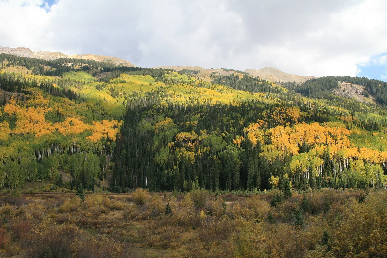
US 550 between Ouray and Silverton reopened after a November storm closure. A storm on November 1 and 2, 2026 dropped 12 to 18 inches of snow above 10,000 feet, set off multiple slides, and shut the corridor from mile point 53 near Purgatory to mile point 92 near Ouray, covering Coal Bank, Molas, and Red Mountain passes. CDOT gave no reopening estimate as of November 9, 2026, COtrip data on November 17 showed the road open with wet pavement and normal traffic at midday, but CDOT closed it at 2 p.m. that afternoon for avalanche mitigation, with the closure expected to last most of the afternoon. Check COtrip.org or call 511 before you set out, because a November story that prints a closure as current without a recheck will be wrong within days. It is a narrow mountain drive with steep drops, long stretches with no guardrail, and grades that reach 8 percent.
The November closure, and the next planned one
The closure ran from mile point 53, at Lime Creek and Cascade Creek just north of Purgatory, to mile point 92 near Ouray. That is a longer corridor than Red Mountain Pass alone. It covered Coal Bank, Molas, and Red Mountain passes, not Red Mountain Pass only. Sources differ slightly on the Ouray end, mile point 92 against mile point 95, so use the CDOT figure on the day you drive.
The signed alternate route when the corridor closes is CO 145 through Telluride, per CDOT releases from November 2026. CDOT also planned a winter operations closure for Monday, November 18, 2026, from 10 a.m. to noon, for helicopter work and avalanche mitigation preparation, with the northbound stop near Ironton Park at mile point 87 and the southbound stop at Bear Creek Bridge at mile point 90.5. CDOT also closed the pass on the afternoon of November 17, 2026, from 2 p.m. for avalanche mitigation, with the closure expected to last most of the afternoon.
Do not treat this story as a live road conditions report. Check COtrip.org or call 511 before you leave Ouray or Silverton, and recheck on the day you drive. Mountain road conditions change with weather, avalanche work, and closures, and a wrong answer sends a traveler onto a road unprepared.
The three stretches, south to north
The drive climbs out of Silverton through the Mineral Creek valley, crosses Red Mountain Pass at 11,018 feet, then descends through the Uncompahgre Gorge into Ouray. The gorge section is the cliff cut stretch south of Ouray. The summit elevation is confirmed by Wikipedia, a CDOT sourced feature, and two secondary sources; the stretch names and character still rest on secondary sources.
Grades reach 8 percent. Curves on the gorge descent call for 15 mph or less, with some sections around 10 mph, per secondary sources. The road narrows to 23 feet in places, averaging 31 feet and reaching 48 feet at its widest, per a CDOT brochure.
Long stretches have no guardrail, and most of the route has no shoulder. The reason, per a CDOT brochure, is that guardrails exist only where the road is wide enough to keep adequate lane width, and narrow stretches have none so plows can push snow directly off the roadway in a range that typically receives up to 300 inches a year. What is settled is the driving consequence: a narrow road, steep drops, and no rail on the famous stretches.
Avalanche country, and the winter picture
The road crosses around 70 avalanche chutes, per one secondary source, and a CDOT spokeswoman is quoted in that same source saying Red Mountain Pass has the highest avalanche hazard per mile of any road on the continent. Both figures come from a single secondary source, and no CDOT statement confirming them was found, so this story prints them only as attributed secondary claims, not as confirmed fact.
Colorado traction law splits by vehicle. Commercial vehicles over 16,000 pounds must carry chains or an approved traction device from September 1 to May 31 on all of US 550, under the Must Carry law, SB 24-100. For passenger cars, the traction law applies when CDOT activates it, so check COtrip and the message boards before you drive.
The November 2026 closure is the winter picture in miniature. The storm closed the whole corridor, not one pass, and CDOT gave no reopening estimate as of November 9, though COtrip data on November 17 showed the road open again at midday, and CDOT closed it at 2 p.m. that same afternoon for avalanche mitigation. A November traveler should expect avalanche work, planned closures, and a road that can shut with one storm. Check COtrip.org the morning you plan to drive.
Where to stop, and where you cannot
Formal pull-offs sit near the Red Mountain Pass summit, with views of the three Red Mountains and mining district ruins, per secondary sources. A few turnouts sit on the Uncompahgre Gorge descent north of the pass, described as the only safe chance to stop on that stretch.
Long stretches have no shoulder and no safe place to stop. Turnouts exist for slow vehicles, per driver reports, but a driver who needs to stop, let a faster car pass, or deal with a flat needs to know before the cliff section, not during it. No pull-off inventory with mile points or coordinates was sourced from CDOT or the counties, so this story prints no mile points for pull-offs. Do not invent them.
Do not stop in the travel lane for a photo. The road is too narrow, and the next car has nowhere to go. Use a turnout, or keep driving to the summit pull-offs.
If something goes wrong
Call M and H Towing and Recovery at (970) 249-8662. The company is based in Montrose at 1237 Spring Creek Road, runs 24 hours a day, 7 days a week, and names Ouray County in its coverage, per its own site as checked November 17, 2026. Montrose sits about 30 miles from Ouray, so the wait from the pass is a real drive, not a quick call.
No Ouray or Silverton based tow operator with a verified own site and a verified current number was found. That is the result, and this story says so plainly. One local daytime option did check out: Timber Ridge Service Station in Ouray, (970) 325-4204, a gas station open Monday to Friday, 7 a.m. to 6 p.m., corroborated by two independent listings. It is fuel and daytime help, not a 24 hour tow service. Rosie's Hookers Alpine Recovery and Midway Roadside Assistance numbers were checked and are not printed here: the first rests on a single secondary list, the second on a page with template errors.
Call 911 in an emergency. The San Juan County Office of Emergency Management non-emergency line is (970) 387-5531, from a Nixle alert footer in November 2026. Save the tow number before leaving town, because the pass is no place to search for one.
Larger vehicles, and which lane to drive
No CDOT rule banning RVs on this stretch was found. Secondary sources agree the road is legal for larger vehicles but not advised for big Class A rigs or long, heavy trailers. The best fit, per dated traveler reports, is truck campers, camper vans, and shorter Class C rigs. Big rigs face tight lanes, 8 percent grades, hairpin turns, and few bailout spots. Do not print a vehicle size rule, because none was sourced.
Drivers report one direction tip worth knowing. Northbound, from Silverton to Ouray, puts the driver on the inside lane against the rock wall. Southbound puts the driver on the outside lane over the drop. That is a tip attributed to drivers, not an agency rule, and a nervous driver may prefer the northbound direction for that reason.
The San Juan Skyway context is that this stretch is part of the 236 mile San Juan Skyway loop, per secondary sources. Byway status confirmation from CDOT or the Forest Service is still open for verification.
After dark, and at each end
Night driving on this stretch is now sourced, from dated secondary advice. A November 8, 2026 winter driving piece advises driving in daylight, warning that curves, drop-offs, ice, and wildlife are much harder to see at night, and suggests staying overnight in Ouray or Silverton rather than driving after dark if delayed. A December 18, 2025 account says locals avoid the road after 6 p.m., citing depth perception, wildlife at dusk, and no guardrails. No agency source on night driving on this stretch was found, so the advice here is secondary, attributed, and dated.
Silverton is the last fuel and food stop before the climb northbound, and Ouray is the end of the drive northbound, per secondary sources. In Ouray, Timber Ridge Service Station keeps Monday to Friday, 7 a.m. to 6 p.m. hours, per its station listing. Other hours and seasonal status for fuel, food, tow, and mechanics in Ouray and Silverton were not verified in this pass. A closed at dark town is a fact on the record, not a gap to fill with a guess, and this story prints no hours it has not verified.
The crash record is secondary and unsettled, with conflicting scopes. Colorado State Patrol figures reported after a 2025 crash put 53 crashes on the relevant stretch, with 33 involving vehicles leaving the roadway, 1 fatality, and 11 injured, while another account says 53 crashes happened on the pass in 2024 alone, and a third cites 412 accidents between mile markers 52 and 92 from 2005 to 2015, with 66 involving injuries and 8 fatalities. That same secondary source calls this the most dangerous mountain pass road in America on an exposure measure. This story does not repeat the superlative without the crash data beside it, and does not present any of these figures as primary confirmed until CSP or CDOT is checked.
Before you set out
Fuel before leaving town. Silverton is the last fuel stop before the climb northbound, and Ouray is the end of the drive the other way. A charged phone matters, and so does a plan for where the drive ends, because the pass has no services and long stretches have nowhere to stop.
Check COtrip.org or call 511 the morning you drive, and recheck if the weather turns. The November 2026 closure arrived with one storm and no reopening estimate, and the road was open again by November 17. The road can shut the same way again.
Drive slow on the narrow stretches, use turnouts for faster traffic, and drive it in daylight if you can. The mountain asks for a careful driver, not a fast one. The companion story on hiking in Ouray covers the trails; this story is the drive, and the two link to each other rather than repeating each other.
Select a passage, then Share to send it with a link.
Questions, answered
- Is the Million Dollar Highway open right now?
- As of November 17, 2026, no: open at midday with wet pavement and normal traffic, per COtrip data, then closed at 2 p.m. that afternoon for avalanche mitigation, expected to last most of the afternoon. A storm on November 1 and 2 closed US 550 from mile point 53 near Purgatory to mile point 92 near Ouray, covering Coal Bank, Molas, and Red Mountain passes, with no reopening estimate as of November 9. A planned winter operations closure follows on November 18, 10 a.m. to noon. Check COtrip.org or call 511 before you drive.
- How long is the Million Dollar Highway between Ouray and Silverton?
- About 21 miles by highway milepost, from mile point 92 near Ouray to mile marker 71 at Silverton. Published sources say 23 to 25 miles, with one outlier at 28 miles. This story carries the range rather than a single figure.
- Does the Million Dollar Highway have guardrails?
- Long stretches have none, and most of the route has no shoulder. Per a CDOT brochure, guardrails exist only where the road is wide enough to keep adequate lane width, and narrow stretches have none so plows can push snow directly off the roadway in a range that typically receives up to 300 inches a year.
- Can I drive an RV on the Million Dollar Highway?
- No CDOT rule bans RVs on this stretch, but secondary sources agree big Class A rigs and long, heavy trailers are not advised. Truck campers, camper vans, and shorter Class C rigs are the best fit, per dated traveler reports. Expect tight lanes, 8 percent grades, and hairpin turns.
- Who do I call if my car breaks down on the Million Dollar Highway?
- Call M and H Towing and Recovery at (970) 249-8662. It runs 24 hours a day, 7 days a week from Montrose, about 30 miles from Ouray, and names Ouray County in its coverage. Call 911 in an emergency. For daytime help in Ouray, Timber Ridge Service Station is (970) 325-4204, Monday to Friday, 7 a.m. to 6 p.m. No Ouray or Silverton based 24 hour tow operator with a verified own site and number was found.
- Where can I pull off on the Million Dollar Highway?
- Formal pull-offs sit near the Red Mountain Pass summit, and a few turnouts sit on the Uncompahgre Gorge descent into Ouray. Long stretches have no shoulder and no safe place to stop. No pull-off inventory with mile points was sourced, so this story names no mile points for pull-offs.
Sources
Checked November 17, 2026.
- CDOT, US 550 closures, Nov 2026 releases, checked Nov 17, 2026
- COtrip, live road conditions, recheck on publish day
- San Juan County OEM, corridor closure MP 53 to MP 92, Nixle alert, Nov 2026
- San Juan County OEM, planned Nov 18 winter operations closure, Nixle alert, Nov 2026
- WorldAtlas, Million Dollar Highway, Sep 25, 2026, secondary
- mostbeautifulroads.com, Million Dollar Highway, Oct 12, 2026, secondary
- mostbeautifulroads.com, Million Dollar Highway closed by snow, Nov 9, 2026, secondary
- M and H Towing and Recovery, own site, 24/7, Ouray County coverage, (970) 249-8662, checked Nov 17, 2026
- mortonsonthemove.com, RVs on the Million Dollar Highway, drove Nov 2025, secondary
- campingkiddos.com, driving the Million Dollar Highway, secondary
- CDOT, Million Dollar Highway brochure, widths and guardrail reasoning, checked Nov 17, 2026
- Outside Online, CDOT sourced feature on Red Mountain Pass plowing, 11,018 ft, secondary
- idyllicpursuit.com, Million Dollar Highway in Winter, Nov 8, 2026, secondary
- travelbinger.com, Million Dollar Highway, Dec 18, 2025, secondary
- Phillips 66 station directory, Timber Ridge Service Station, Ouray, (970) 325-4204, Mon-Fri 7 AM-6 PM, checked Nov 17, 2026
More from Ouray
- Walk the loop around town, or climb to the mine ruins?
The Perimeter Trail circles the whole town in one loop. Bear Creek climbs to mine ruins with real exposure. Which hike fits your day, and what is closed in winter.
More to read
- Cottonwood’s chocolate shop began in a Michigan kitchen
The Michigan kitchen behind a Cottonwood chocolate shop, with truffle fillings to explore and a box to take home.
- A bookshop with a life after the last page
A bookshop that still acts like a small arts institution. Open daily in the Saint George lobby, with a gallery show on the record in June 2026.
- A quieter night under St. Augustine’s lights
More than three million white lights, free, over the oldest city in the country. Go on a weeknight, park once, and walk.